

From No Maps to Light Maps: The New Competition Among Map Providers in the Age of Large Models
The Era of “Large Models + Light Maps”
As advanced driver assistance technology evolves, the map technology and competitive landscape among map providers are also quietly changing.
2021 marked a crucial milestone for advanced driver assistance entering urban areas. The following year, automotive companies launched a “de-high-precision mapping” trend to accelerate achieving the goal of “driving nationwide.” However, with the popularization of urban NOA (Navigate on Autopilot), due to strict requirements for safety, comfort, and continuity, people quickly realized that driver assistance systems could hardly operate independently without maps.
But simply continuing the traditional approach of relying heavily on mapping vehicle fleets for data collection seemed inadequate in the face of strong demand for large-scale adoption of driver assistance. Therefore, innovative forms such as light maps/cloud maps emerged.
Over the past few years, leading map providers including AutoNavi, Baidu, and Tencent have all adjusted their strategies, launching various “light map” products that update faster and cost less, including HD Air/HD Lite/SD Pro, among others.
Behind the transformation of map formats, beyond adapting to the technological iteration of driver assistance itself, lies a shift in the market landscape. In the high-precision mapping era, AutoNavi and Baidu held dominant positions, but as light maps became the mainstream choice for automotive companies, Tencent Maps emerged as a standout.
According to data from Gaogong Intelligent Automotive Research Institute, Tencent has provided intelligent driving map services for urban NOA systems of automotive brands including NIO, Ledo, Zeekr, and WEY, capturing 49.01% market share of the standard urban NOA intelligent driving map market for new energy passenger vehicles (excluding range extenders), ranking first. AutoNavi ranks second with 47.9% market share in the new energy market (excluding range extenders) for standard urban NOA intelligent driving maps.
The intelligent competition among new energy vehicles is currently intense. With end-to-end technology being deployed in vehicles, AI large models have brought revolutionary changes to driver assistance development, and map formats will continue to evolve accordingly. The competition among map providers is far from over.
Among them, whoever can first identify trends and firmly embrace new trends will be the first to reach the new continent.
From No Maps to Light Maps: The Evolution of Intelligent Driving Map Formats
Following the progress of automotive companies in mass-producing driver assistance systems, the development of intelligent driving maps has roughly experienced three stages:
Initially, there was the honeymoon period for high-precision maps. From 2018 to 2021, more and more automotive companies began mass-producing L2+ driver assistance systems. Dozens of brands including XPeng, NIO, Li Auto, BAIC ARCFOX, Changan Avatr, and GAC successively mass-produced highway combined driver assistance functions, bringing rapid development to high-precision maps for highways and urban expressways.
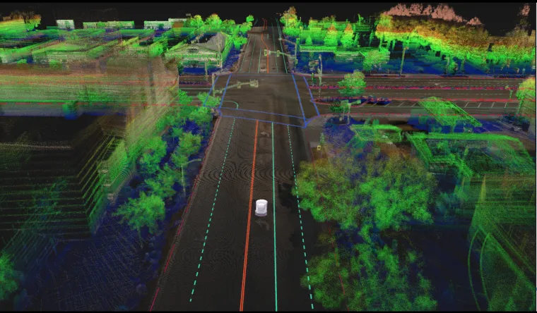
Urban high-precision map example, Image source: DeepMap
The second stage was the aggressive period pursuing “driving without maps.” After 2021, as driver assistance entered urban areas, due to constraints from regulations, costs, and update frequency, high-precision maps, after supporting several pilot cities, could not quickly expand nationwide, creating a fundamental contradiction with automotive companies’ car-selling demands.
At that time, the industry believed that high-precision maps, constrained by factors such as cost and element updates, could hardly meet automotive companies’ needs. After all, passenger cars need to run nationwide, and obviously high-precision maps could not satisfy user demands. Therefore, achieving “nationwide driving without maps” became the competitive high ground for major automotive companies and driver assistance companies in 2022.
It’s said that during those two years, automotive companies would use flatbed trucks to pull suppliers’ test vehicles to randomly selected locations to see if they could run properly when deployed, testing whether it was “truly mapless.” Many civilian testers specifically chose remote suburban roads for live streaming driver assistance, as such road segments obviously wouldn’t have pre-collected high-precision maps.
But “no maps” came at the cost of sacrificing experience to some degree.
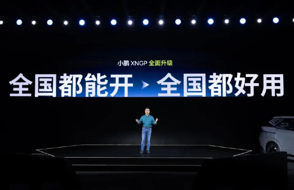
Image source: Official automotive company
Comparing systems with “high-precision maps” and those “without high-precision maps” at the time, it was easy to see that the latter would show capability regression on slightly more complex road segments. Moreover, so-called “no maps” didn’t mean completely mapless – at minimum, navigation maps needed to exist.
Currently, we’re in the rational period of returning to “light maps.” Entering 2024, as driver assistance gradually spreads nationwide, automotive companies entered a red ocean stage competing on user experience. Safety, continuity, and comfort became the three most important indicators for measuring driver assistance experience.
From the second half of last year until now, numerous automotive companies began launching new-generation driver assistance systems based on end-to-end large models. From actual testing performance, driving game theory is where new-generation large model systems show obvious improvement; however, recognition of complex road structures is a shortcoming of large model systems.
Light high-precision map solutions perfectly address the needs of this transformation.
For example, some lane change points, left/right extensions at intersections, even connectivity relationships at complex intersections, experiential driving trajectories, etc. – this beyond-visual-range information is undoubtedly crucial for the safety, continuity, and comfort of driver assistance.
In comparison, the transition from high-precision elements to rich semantic information is an important characteristic of light high-precision maps. When early driver assistance used high-precision maps, geometric requirements for roads were high, requiring very high precision. At the current stage, leading driver assistance teams don’t have extremely high requirements for geometric precision, but they need more and more detailed beyond-visual-range, semantic content, such as topological connection relationships, navigation guidance information for complex intersections, lane guidance information, etc.
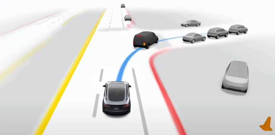
Image source: Official automotive company
To date, mainstream Chinese market automotive companies including Zeekr, Changan, BYD, and even Tesla have adopted light high-precision map solutions to varying degrees in their vehicles.
The installation volume of intelligent driving maps also shows rapid growth. According to Gaogong Intelligence data, in 2024, urban NOA installations of intelligent driving maps in China’s new energy passenger vehicle market (excluding imports/exports) exceeded 700,000 units.
After several years of evolution, from loudly proclaiming “no maps, remove maps” to “light maps are wonderful,” the value of intelligent driving maps has obviously been re-demonstrated. Accompanying the evolution of intelligent driving map formats, competition among map providers has become increasingly fierce, and their market positions have quietly changed.
The Light Map Era: Why Did Tencent Maps Stand Out?
Early on, due to the lack of clear systematic policy constraints on maps for driver assistance, the map market saw diverse players flourishing, with some automotive companies even acquiring map providers with surveying qualifications, hoping to autonomously cover map collection.
But in 2022, this phenomenon came to an abrupt halt. In July of that year, the Ministry of Natural Resources issued the “Notice on Promoting the Development of Intelligent Connected Vehicles and Maintaining the Security of Surveying and Geographic Information.” The Ministry of Natural Resources determined that autonomous vehicles collecting road environment information constitutes surveying behavior, including data collected during autonomous driving tests, intermediate data from sensors, etc., which can only be operated by enterprises with Grade A surveying qualifications for navigation electronic map production issued by the state.
At that time, relevant national authorities conducted reviews of domestic enterprises’ high-precision map surveying qualifications. 19 enterprises including AutoNavi, NavInfo, and Tencent Dadi Tongte passed the qualification review, while previously 31 enterprises had Grade A surveying qualifications, a decrease of 12 companies. This caused the map market to begin concentrating toward leading players.
In the traditional high-precision map market, traditional map providers such as AutoNavi, Baidu, and NavInfo occupied dominant positions. Entering the light map era, Tencent Maps began to stand out.
Why? This stems both from Tencent’s team’s technical predictions and their more open, flexible positioning.
As early as 2022, based on predictions about the technological development trends of the driver assistance industry, Tencent Maps began transitioning from high-precision maps to light high-precision maps. On one hand, they updated coverage scope and freshness for existing highway and urban expressway high-precision map business in cooperation with automotive companies; on the other hand, Tencent’s light high-precision maps (HD Air) began taking initial shape.
Through cooperation with automotive company customers like Changan and Zeekr, Tencent completed the convergence of intelligent driving cloud map product definition in about six months to a year. In April 2023, Tencent officially released HD Air, a lightweight high-precision data product for urban driver assistance scenarios.
Last year, Tencent further launched “Tencent Maps Vehicle Version 8.0” cabin-driving integrated solution, further classifying, integrating, and processing map data elements at various levels. Through a unified map and data platform, it achieves human driving and vehicle driving sharing one map and one dataset.
That is, map data of different precision levels such as Standard Navigation Maps (SD Map), Light High-Precision Maps (HD Air), and High-Precision Maps (HD Map) can achieve data homology and quality consistency; moreover, modular toolchains can support automotive companies in flexibly taking necessary map elements as needed.

Tencent Intelligent Driving Cloud Map, Image source: Official company
Traditional maps often used offline data packages for delivery, while Tencent can provide map data through cloud services, including both “cloud-to-edge” and “cloud-to-cloud” modes. This is now Tencent’s externally output “Intelligent Driving Cloud Map” solution.
“Cloud-to-edge” refers to delivering the latest changes in map data, dynamic traffic and environmental information, driving experience data, etc., to the vehicle end to enhance experience. “Cloud-to-cloud” means directly interfacing with automotive companies’ driver assistance clouds, where automotive companies can fuse intelligent driving cloud map data with their own data, thereby maximizing the value of their proprietary data.
Another core advantage of intelligent driving cloud maps is the expandable multi-layer data format. Simply put, it’s not a “fixed map” but a “growing, operable map ecosystem” that can support flexible ODD configuration, plug-and-play online services, and provide operational toolchains. Automotive companies can quickly adjust according to their needs.
On the driving experience layer, it can also flexibly co-build with automotive companies, jointly creating “environmental experience layers” and “driving behavior experience layers.” For example, where are bumpy roads and what speeds are recommended, where are dangerous sections requiring caution, even lane-changing modes, curve speeds, new energy road energy efficiency indices, etc. These “experiences” can make driver assistance more like an “experienced driver.”
Meanwhile, since map elements can be released by navigation route or region, it can also support differential updates from vehicle-end sensors. Static elements like speed limit signs, electronic eyes, and lane lines enter the data flow based on confidence levels, with some achieving daily updates, while dynamic elements like road conditions, lane-level traffic incidents, and severe weather can achieve real-time release through vehicle-end perception feedback and ecosystem partner support.
From basic map layers, update element layers, to customer data layers, driving experience layers, operational layers, dynamic ODD layers… automotive companies can freely combine like building blocks to meet different scenario needs.
Currently, the intelligent driving map market presents a “dual oligopoly dominance, multi-element competition” pattern. Tencent and AutoNavi monopolize over 96% of the urban NOA market share, Baidu and NavInfo maintain advantages in traditional fields, while Huawei indirectly influences map demand through full-stack solutions.
Although Tencent Maps achieved overtaking in the light map era through accurate prediction of technology trends and determination for transformation, the industry is far from reaching the endpoint of competition. With the arrival of the AI large model era, the format of intelligent driving maps continues evolving, and competition continues.
Intelligent Map Competition Is Far From Over
From initially pursuing “no maps” to now deeply exploring light high-precision map technology, automotive companies and industry chain players have gradually recognized: maps are not a “burden” for driver assistance, but a “weapon” for improving driver assistance experience.
Precisely because of this, the volume of the intelligent driving map market is growing rapidly and steadily with the large-scale popularization of urban driver assistance. According to predictions by Taibo Research Institute, the intelligent driving map market will reach 5.4 billion yuan in 2025, and is expected to reach 11.7 billion yuan by 2030.
However, map formats are still not at their final stage. With the arrival of AI large models, map formats continue changing.
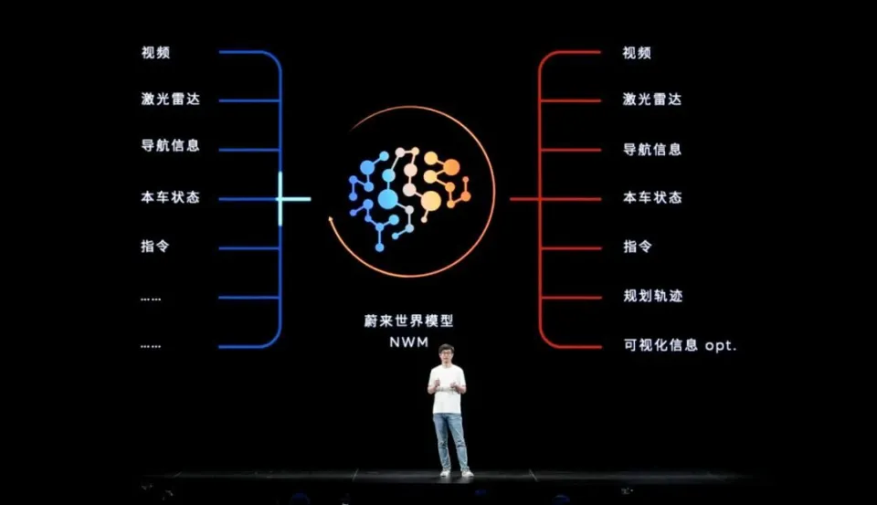
NIO World Model, Image source: Official automotive company
The deployment of end-to-end technology has given AI large models revolutionary impact on driver assistance development methods, driving new evolutionary directions for map formats. Future maps will no longer be limited to traditional databases rich in high-precision elements and road geometry, but will gradually integrate into models, becoming organic components of large models.
Large models are essentially a form of knowledge compression, which means future map formats may ultimately exist in model form, and through autonomous driving system perception systems, geographic location environmental information data serves as observational information given to large models. Large models, through reasoning and judgment of data, ultimately provide planning and execution results.
Besides changes in map data formats themselves, large model technology will also affect every link from map collection and production to simulation verification.
Of course, the development of large models will bring new format changes to the map industry, and will inevitably lead to changes in the entire industry landscape. Whether new or established players, only those who can grasp new paradigms will gain more share in new fields.
For map providers like Tencent who laid out early, the industry’s renewed recognition of intelligent driving maps brings unprecedented development opportunities, but map evolution hasn’t reached its endpoint, so industry competition won’t stop either. Whoever can firmly embrace the future may ultimately achieve victory.